About

mdLiDAR3000 is an end-to-end LiDAR solution combining a drone, a LiDAR payload, and a fully integrated software workflow with convenient payment plans and data processing options.
Who Should Consider This System:
As you’ve come to expect, Microdrones provides you with the full solution: Plan, Fly, Process, Visualize. Only Bigger.
This is a serious machine for serious geomatics professionals in the construction, land development, engineering, surveying and research trades. It’s field tough and ready to work with you on the following tasks:
Digital Twin Creation and Maintenance
Corridor mapping
Mining (volume calculation)
Construction site monitoring
Environmental changes (time series)
Forestry
Contour mapping
Leveling/Excavation
Archaeology and cultural heritage
Highway construction
THE COMPLETE PACKAGE TO ADD UNMANNED AERIAL LiDAR TO YOUR GEOMATICS SERVICES
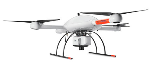
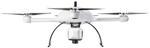
The mdLiDAR3000 uses the lifting power, resilience and efficiency of the Microdrones aircraft platform to carry a perfectly integrated Riegl miniVUX‑3UAV and a Sony RX1R II camera. The result? You can quickly acquire high density and accurate LiDAR data in the field and efficiently turn it into a 3D colorized pointcloud back at the office or on your laptop.
PARAMETERS
| Parameter Name | Parameter Value |
|---|---|
| Type |
quadcopter
|
| Applications |
|