About
Geo-Data Converter CVT-Pro
Conversion of Measuring data
123
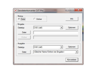
CVT-Pro is easy to use and features the fast and reliable conversion of various geodetic data formats.
Supported file formats:
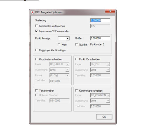
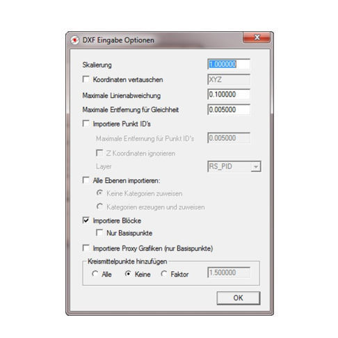
CAD DXF (import up to AutoCad 2019, export AutoCad R12)
CST/Berger (CST)
Geodimeter (ARE)
Leica GSI-8 and GSI-16
Microsoft Excel (CSV)
REB DA11 (for area calculations in accounting software on RoboStation-XML basis)
REB DA30, 45, 49
RoboStation XML
Scalable Vector Graphics (SVG)
Sokkia SDR33
Text with arbitrary format
Topcon (KOR)
Basic object types are 3D-polygons consisting of points and edges. Object types like circles, ellipses, splines, etc. are automatically converted into corresponding 3D-polygons.
Available options:
scaling
coordinate swap
add midpoints of circles
add pointnumbers or coordinates as text
Highlight polygon points
Replacing blocks through anchor points
and many others...
CVT-Pro supports layers well known from standard CAD software. Point- and polygon-categories (RoboStation XML-format) are supported as well.
Beyond the features of the converter’s standard version, which is delivered together with the PlanAssistant fieldbook, CVT-Pro comes along with most useful functions.
PARAMETERS
| Parameter Name | Parameter Value |
|---|---|
| Type |
measuring
|
| Other characteristics |
fast
|