About
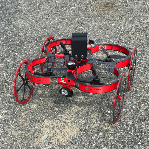
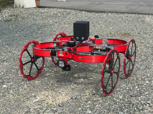
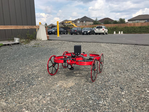
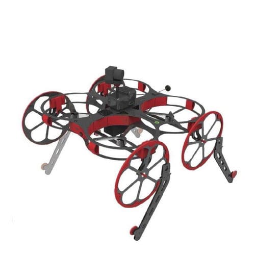
TILT RANGER is a unique flying drone customized with tilting-rotor technology. This multi-copter is integrated with 3D laser mapping system based on SLAM technology. It is especially designed to inspect, scan and create 3D maps of underground mine drifts, stopes, ore passes and other underground openings. Thanks to the SLAM technology, this drone is capable of scanning and mapping in GPS-denied areas. The drone operates at 2.4 GHz radio with circularly polarized antenna. It is capable of flying in non line-of-sight and total dark areas.
This highly rugged drone has been specially designed for challenging environment of underground mines. It is equipped with wheels and propeller guards, which protect the drone from damage while hitting the walls and other objects. The cover protects the electronics from dust and water. The tilting rotor servos are waterproof. The tilting rotor technology with wheels allows the drone to be rolled on flat and inclined surfaces as well as hover at steep angles.
The TILT Ranger enables rapid data capture of 3D point cloud and map generation. The scanner has both moving and stationary scan capabilities, which can be set by an operator through a GUI running on a tablet connected to the drone via Wifi. This connection is required only at the start and end of the flight. This competitively priced system can be used by anyone, including those new to surveying and laser scanning.
The point cloud data and video clips from the drone can be uploaded via Wifi or through an available USB drive. From the point cloud, the system generates the map in three dimensions.
PARAMETERS
| Parameter Name | Parameter Value |
|---|---|
| Type |
multicopter
|
| Applications |
|
| Other characteristics |
|